Heat Leaves Thursday, Below Average Weekend Temperatures
Forecast:

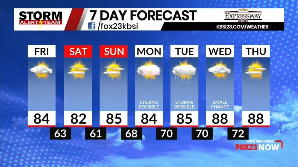
Cape Girardeau will see temperatures today in the mid-80s with partly cloudy skies. A few sprinkles may be possible today with a north breeze between 5 and 10 miles per hour.

Taking a look at Stormcast, the best chances for isolated showers and thunderstorms will be off to our southeast this afternoon.

Low temperatures tonight are cooler than what we have seen the past couple of nights, with lows near average in the middle and upper 60s. Mostly cloudy skies and a small chance of showers with a north-northeast wind.

High temperatures on Friday will be a few degrees below average as the prolonged heat wave comes to an end with a cold front moving through our area on Thursday. Tempertures will reach the lower 80s with mostly sunny skies and a north-northeast wind at 5 to 10 miles per hour.

Cape Girardeau will reach the mid-80s to close out the work week. Mild temperatures for the morning commute as a northeasterly wind helps keep us cool. Some afternoon cloud cover is possible, but conditions outside will feel much better compared to the last several days.

Dew points finally dip below 70 degrees on Friday as well. During our latest heat wave, Cape Girardeau saw a record-setting 25 straight days (July 6 – July 30) of 75-degree dew points or higher, according to the National Weather Service Office in Paducah, Kentucky. The previous record of 18 days took place from July 14-31, 2010.

August begins tomorrow, and high temperatures will remain below average heading into the weekend. Storm chances return on Monday and Tuesday before seasonable high temperatures return to the upper 80s by the middle of next week.
Storm Alert Team Meteorologist
Dominic Ferraro