Storm potential Tuesday; slow but sure cool down
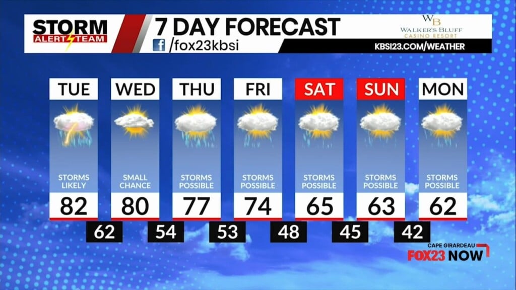
Scattered showers and storms will become likely as Tuesday wears on. We get a break on Wednesday, then more chances for storms the 2nd half of the week. Temperatures will be on a downward trend all week.

Storms will push through in the afternoon and evening on Tuesday. Some may be strong to severe. We’re on the eastern edge of the storm threat, so the severe potential weakens quickly as storms move east.
Above is what our StormCast model has for timing as the storms move through.

We are on the very eastern edge of the severe weather potential, but regardless, there is a risk for tornadoes.

Large hail is also a possibility, but the threat lessens the further east you go.

Damaging wind will also be possible as the storms blow through Tuesday afternoon and evening.

Wind gusts in excess of 30 mph will be possible even before the storms move in.

Temperatures will be WELL above average Tuesday afternoon.

The best chance for rain and storms is from around 3pm Tuesday through 1am Wednesday.

After a break on Wednesday, storms will be back in the forecast each day. Cooler air moves in, too!
Storm Alert Team Chief Meteorologist
Rusty Dawkins


