Sunny and Much Warmer for Friday

Temperatures will remain slightly above average for mid-November throughout Thursday afternoon and into the evening.

Thursday got off to a cold start across the Heartland, with many of our overnight lows dropping close to freezing.
The latest runs of Stormcast keep us free from precipitation through the rest of the work week. A few passing clouds will be possible, but no chances for rain in the forecast until early next week.

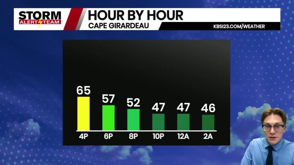
Lows tonight will be well above average in the middle and upper-40s.

We are looking at a calm evening ahead for Cape Girardeau under mostly clear skies. Our low temperatures will be in the mid-40s under mostly clear skies.

Much warmer on Friday as many of us will see the middle and upper-70s! Highs for tomorrow will be close to 20 degrees above average.

Mostly sunny skies are expected throughout the day in Cape, with breezy conditions out of the south-southwest. Keep a jacket handy as you head out the door, but you should not need it by the time we get to Friday afternoon, with highs in the mid-70s.

Another day well above average on Saturday before cooling back into the lower 60s on Sunday. Rain chances enter the forecast starting Monday evening, with widespread showers possible off and on throughout most of next week. Highs will continue to be near-average in the lower 60s next week.
Storm Alert Team Meteorologist
Dominic Ferraro


