Storm chances Saturday
Storms are going to roll through on Saturday, but we dry out on Sunday and stay that way through the first half of the week.
For the latest severe weather alerts, go HERE.
For up to the minute radar, go HERE.
For a live look from our weather cam network, go HERE.
And we would love to see video of any storm footage you may get (safely!). You can upload that using our Now Local News App HERE.

There is a level 1 Marginal Risk and a level 2 Slight Risk for much of our viewing area Saturday. The better risk for storms will be in the level 3 Enhanced Risk to our west.
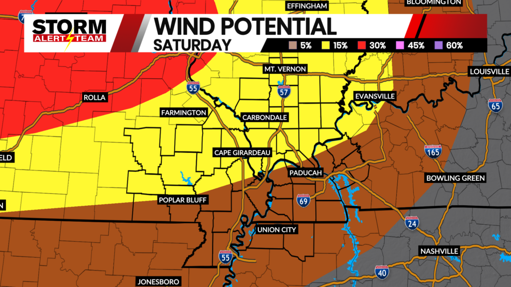
Above is what our StormCast weather model is saying for timing, duration, and location of the storms on Saturday. There will be a couple of waves that move through. The main threat will be in the evening hours.

We are on the very edge of a small chance for a tornado Saturday evening.

The threat for large hail should also diminish as it gets into our area. Still, 1″ hail is a possibility.

The main threat will be damaging wind, especially the further west you go.

Highs Saturday afternoon will be very close to normal.

Storm Alert Team Chief Meteorologist
Rusty Dawkins