Nice Monday Before Storms Return
Monday afternoon looks to be very pleasant! High temperatures reaching the mid to upper 70s and low 80s under sunny skies. Monday night looks perfect for any outdoor activities.

NE winds will stay light through Monday afternoon and evening!

Storm Chances Tuesday
1-3pm: A few Strong to severe storms will move W->SE Tuesday afternoon across the area. A few Storms will be capable of strong winds & large hail. If you plan on camping or staying near the river, keep a close eye on the weather as flooding & wind will be a concern through Wednesday night.

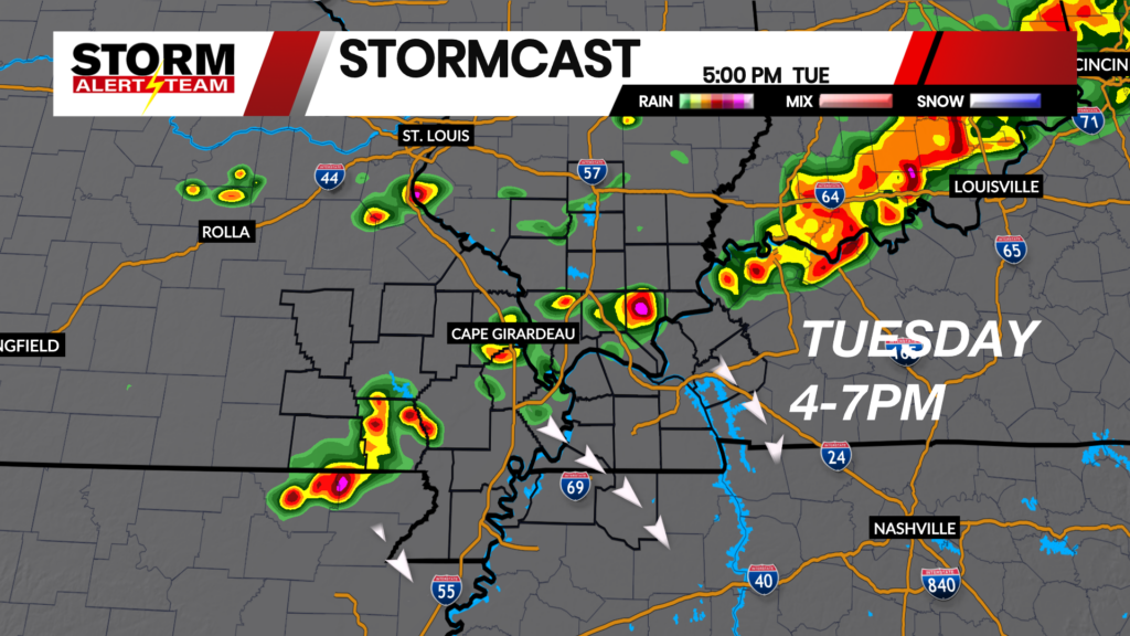
4-7pm: A few storms will try and intensify as they move across Cape G, western Kentucky & SE Missouri. Damaging winds and hail will be the main concerns during this time period.

Severe Weather Wednesday
A line of storms is expected to move in Wednesday evening into the overnight hours. These storms will be capable of damaging winds, hail and a brief tornado threat the farther SE & north you are.

A damaging wind threat could occur late Wednesday into early Thursday. More details to come as we get closer. Stay tuned for the latest.

Meteorologist Houston Hall

