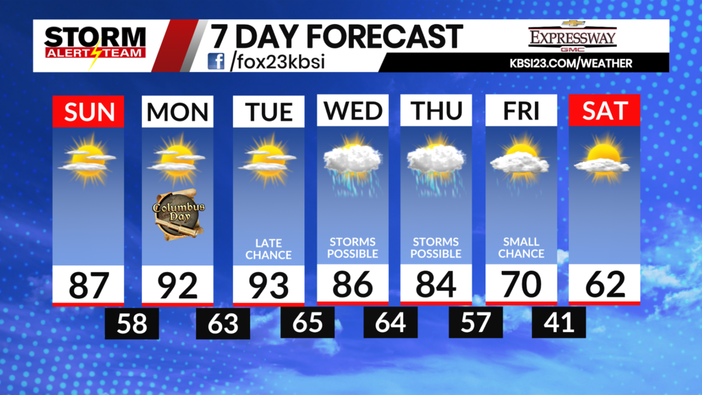
Isolated Storm Chances Wednesday Night, Sunny into the Weekend

Northerly winds will help bring down humidity by just a little bit on Thursday through the heartland. That being said, forecast highs remain in the upper 80s with feels-like temperatures expected in the lower 90s.

One to two strong or severe storms cannot be ruled out later this evening and into early Thursday morning. A Marginal Risk (Level 1 out of 5) of severe weather is in place for most of the viewing area. Damaging winds would be the main concern in any isolated storms in our area, though large hail remains possible as well.
The latest run of StormCast agrees with storm chances being fairly isolated for the viewing area Wednesday evening and into the overnight.

Temperatures by early Thursday will only fall to the upper 60s and lower 70s across most of the viewing area.

Outside of a small chance of a shower and thunderstorm, it will be an otherwise quiet evening in Cape Girardeau. Partly cloudy skies will persist through the overnight hours.

Highs will be close to average again on Thursday afternoon in the Heartland. Expect temperatures in the upper 80s to lower 90s for most.

A seasonal late August day in Cape under mostly sunny skies for Thursday. A light northerly wind should keep feels-like temperatures no warmer than the lower 90s during the hours of peak heating.

High temperatures return to the middle and upper 80s on Friday, before warmer weather arrives heading into the weekend.

A warmer air mass moves into the Heartland through the weekend and into the start of next week. High temperatures are forecast in the middle 90s on Monday and Tuesday, with increasing humidity. Chances for precipitation are few and far between for the week ahead.
Storm Alert Team Meteorologist
Dominic Ferraro