Remnants of Isaias Bring Saturday Rainfall, Warmer Weather Returns Next Week

Saturday will bring an end to our latest stretch of above-average temperatures, though not for long. Afternoon temperatures are expected to reach only the lower and middle 70s with the remnants of Hurricane Isaias moving through the Heartland.
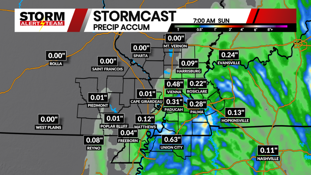
The latest runs of StormCast show bands of rainfall from Hurricane Isaias arriving by lunchtime on Saturday. Chances for showers will continue through the afternoon and evening, particularly for the eastern half of the viewing area.

Models continue to track the center of low pressure further to our east, which is good news for any flooding concerns across the area. That said, localized rain totals upwards of an inch remain possible through the day on Saturday.

It will only take the leftovers from a hurricane, but several spots across the viewing area will see highs close to average on Saturday afternoon.

Overcast skies will persist for most of the day in Cape Girardeau, with chances for showers increasing by the lunch hour.

We will add a couple of degrees to those afternoon temperatures on Sunday. Those in the viewing area who can dodge the early cloud cover will return to well above average temperatures.

Cooler weather will not stick around for long, as we see another surge to the upper 80s and lower 90s next week. Confidence is building of another cold front moving through later in the week, which will bring relief from the heat and the potential for showers and thunderstorms.
Storm Alert Team Meteorologist
Dominic Ferraro