SEVERE Storms LIKELY Monday Evening
Numerous severe storms will be LIKELY across the region this afternoon and evening. A few strong tornadoes EF-3+ will be possible if not LIKELY. Now is the time to review your severe weather plan, know your place of shelter, and ensure you have multiple ways of receiving severe weather alerts. TIMING: 3pm Monday-1am Tuesday.
The greatest storm coverage & risks are expected this afternoon through tonight. Isolated storms develop across SE Missouri, southern Illinois & western Kentucky by this afternoon near 2-3pm. These 1st initial cells will have the best potential for tornadoes & large hail.
- Latest Storm Alert Team Weather Alerts: Click Here
- For up-to-the-minute radar: Click Here
- Latest Watches/Warnings: Click Here

The tornado potential begins around 3–4 PM, with peak timing between 6–11 PM.. The first storms will have the greatest tornado potential and LARGE HAIL.

6-8pm: Widespread scattered strong to severe storms will occur across the viewing area. The circled areas are the best potential for seeing a tornado during this timeframe.

LARGE HAIL up to golf balls or greater will be likely with these storms this evening.

Here is the timeline of storms through Monday night:
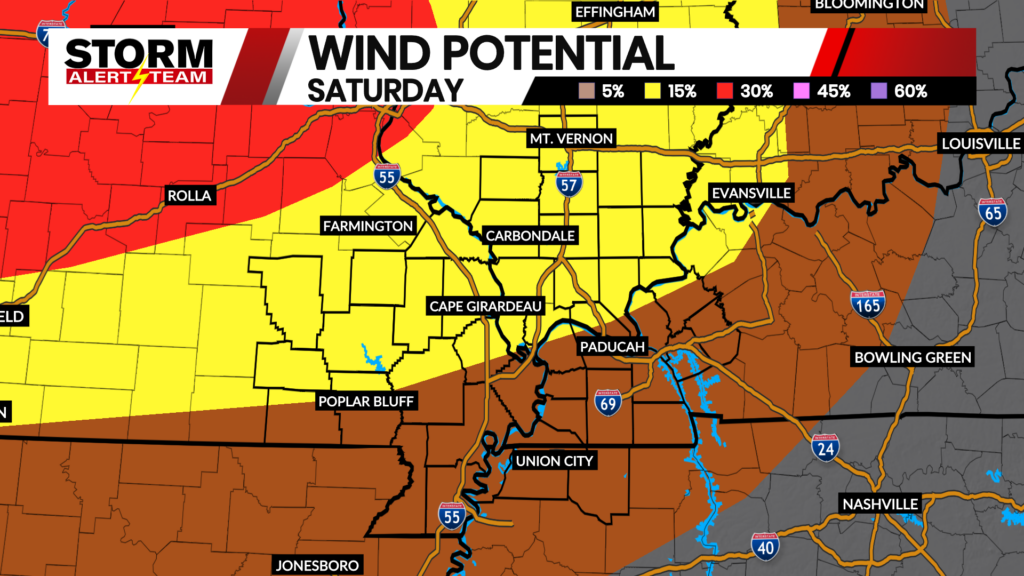
DESTRUCTIVE straight line winds (80+mph) will be possible within the line of storms by the late evening into the night time. Take in any outdoor objects that could blow away.

This line of storms will move through by 8pm-midnight carrying all hazards. Periodic spin-ups, damaging straight line winds & large hail.

Meteorologist Houston Hall