Sunny, Seasonal end to the Week

Calm conditions continue into the end of the work week after Wednesday evening’s strong thunderstorms ravaged the viewing area. Friday will feature mostly sunny skies and highs near average, in the middle to upper 80s.

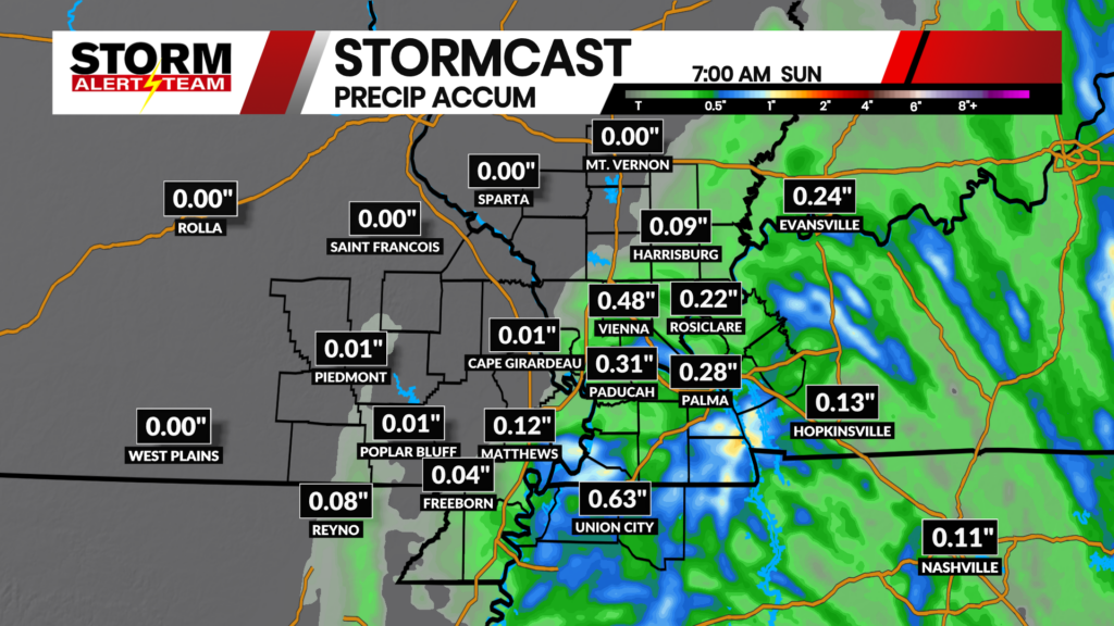
Above are 24-hour rainfall totals as of 3 p.m. on Thursday, August 20. Several reports of 5.00″+ of rainfall came in from southeast Missouri from Wednesday night’s storms. Note: These are observations combined with radar-estimated rainfall; several areas that are listed as 0.00″ likely saw rainfall, though have yet to be reported.
Chances for showers and thunderstorms remain minimal through the end of the work week, according to the latest runs of StormCast.

Overnight temperatures will be near-average for most across the viewing area. Winds remain light heading into Friday morning under mostly clear skies.

Patchy areas of fog cannot be ruled out early on Friday morning and for portions of the morning commute. Otherwise, mostly clear with lows in the upper 60s in Cape Girardeau.

We should see afternoon temperatures close to average on Friday afternoon as well. High temperatures across the Heartland will reach the middle to upper 80s and lower 90s.

Cape should see plenty of sunshine on Friday afternoon with a light breeze out of the north. High temperatures will climb to the upper 80s to round out the work week.

Temperatures will stay at or below average for the week ahead with quiet conditions through the start of the weekend. Small chances for showers and thunderstorms are introduced to the forecast as a front drifts south and stalls out over the Heartland.
Storm Alert Team Meteorologist
Dominic Ferraro