SEVERE Storms & Flooding Through Sunday
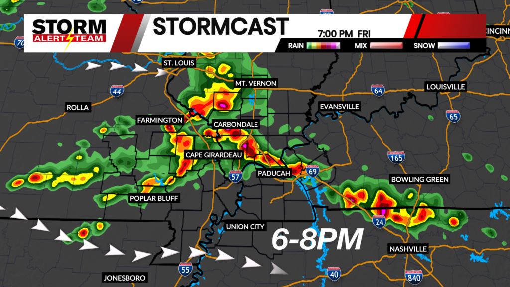
The main threats Friday evening into Saturday morning will be STRONG WINDS up to 65+ mph, Hail up to half dollars or greater, isolated tornado threat and flash flooding. TIMING: 6PM Friday-4AM Saturday.
- Latest Storm Alert Team Weather Alerts: Click Here
- For up-to-the-minute radar: Click Here
- Latest Watches/Warnings: Click Here

6-8PM: Strong storms will move W->ESE Friday evening in SE Missouri, southern Illinois & western Kentucky . Storms will be capable of winds up to 65+ mph,small hail, a brief tornado threat and flash flooding.

9-11PM: Strong storms will move into western Kentucky, carrying winds up to 65+ mph, small hail and even a brief tornado.

SEVERE Weather Saturday: July 11, 2026
Strong to severe storms look to move in again Saturday morning & afternoon. The severe threat a bit lower and south, but still gusty winds up to 65+ mph will be the main concerns along with flooding.

3-7AM: Early Saturday morning, scattered storms will move NW->ESE through Cape G and much of the area . Storms will be capable of winds up to 55+ mph and small hail, along with heavy rainfall.

3-7PM: Saturday afternoon and evening, the stronger storms will look to stay farther south & west with SE Missouri, Arkansas and Tennessee getting the bulk of the rain/storms.

Rain through Sunday morning: Through this whole weather event (Sunday), additional rain totals up to 4-6″ will be possible within a few areas across Kentucky and Illinois.

A FLOOD WATCH is in effect through Sunday morning. Additional rain totals could exceed 4-6″+ through Sunday, especially for parts of Kentucky, Illinois & Tennessee.

Meteorologist Houston Hall