Rain & Storm Chances Increasing Saturday
A WARMER Wednesday across the south! High temperatures reaching the mid to upper 80s under sunny skies & light winds. Humidity & warmth will rise through Saturday.

SW winds will be light for much of us. Gusts could reach 15+ mph through your Thursday afternoon.

Friday morning, temperatures will feel a bit warmer! Most of us will wake up to temperatures in the 50s under clear skies & light north winds.

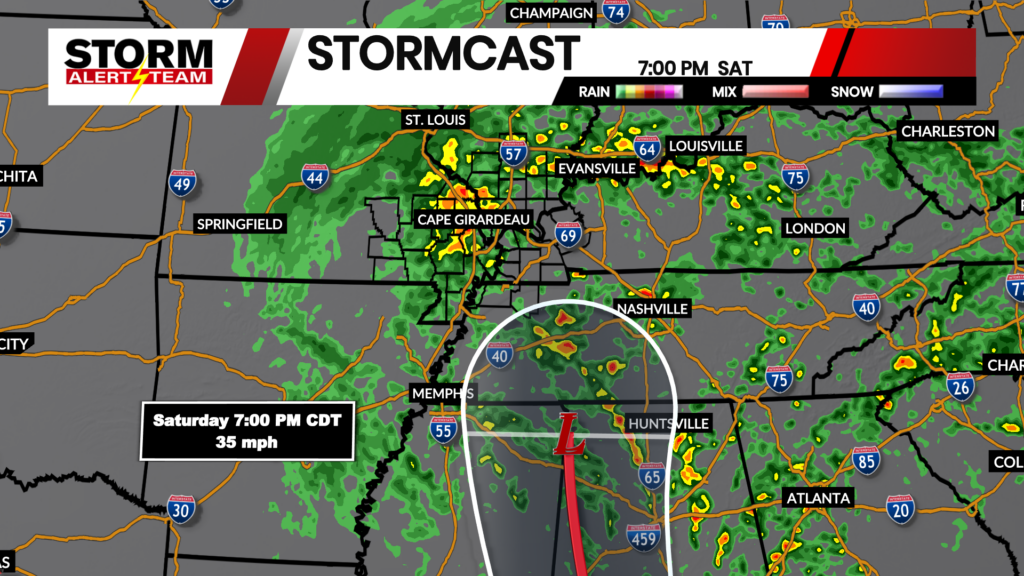
The National Hurricane Center has the system as a WEAK LOW by time it reaches our area Saturday afternoon/evening. Winds and local flooding will likely be the main concerns across our area.

Saturday morning & afternoon, rain/storms and wind will move into our area moving S->NE.

Rain & storms will continue Saturday night into Sunday morning.

Rainfall potential through Sunday looks the best from Cape G & eastward. Rain totals could exceed 1-2″ across Kentucky, S Illinois & Tennessee.

Meteorologist Houston Hall