Nice Friday Before SEVERE Storms Saturday
Friday afternoon looks to be very pleasant after some morning storms! High temperatures reaching the mid to upper 80s with sunny skies after 11am. Friday night looks perfect for any outdoor activities.

NE winds will stay light through Friday afternoon and evening!

Severe weather Saturday
7:11am: Strong to severe storms will move W->SE Saturday morning in SE Missouri. Storms will be capable of strong winds, large hail and even a brief tornado threat. If you plan on camping or staying near the river, keep a close eye on the weather as flooding will be a concern through Saturday night.

A small tornado risk is in place for much of the viewing area Saturday. The tornado threat will begin Saturday evening and continue through the overnight.

11am-2pm: Storms will move across the viewing area, carrying a damaging wind, hail & brief tornado threat.

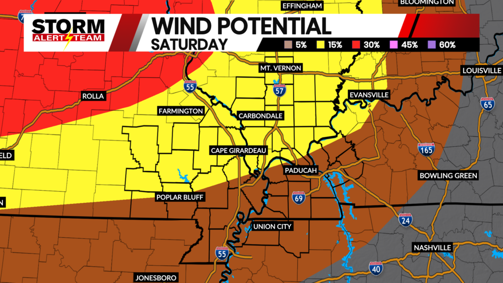
Damaging winds up to 65+ mph will be associated with the line of storms Saturday. Make sure to take in objects that could blow away. Potential for power outages will be possible as storms move through Saturday morning and night.

Sunday morning will bring the last round of severe storms. Make sure to have ways to receive alerts as storms will move through into the overnight hours. All hazards will be possible Saturday night into early Sunday morning.

Areas of flooding will be a concern with these storms through Saturday night. Rain totals up to 2-4″ possible.

Meteorologist Houston Hall

