SEVERE Storms Tuesday Afternoon
The main storm threats will be large hail up to ping pong balls & damaging winds up to 65+ mph. The tornado threat lays farther south and SW. TIMING: 4pm -10pm Tuesday.
4-7pm: A cluster of storms will move in from SE Missouri, carrying a large hail & damaging wind threat. Storms will have a ESE motion through tonight.
- Latest Storm Alert Team Weather Alerts: Click Here
- For up-to-the-minute radar: Click Here
- Latest Watches/Warnings: Click Here

7-10pm: A few scattered T-storms could carry a hail and wind threat from Springfield & east through Cape G. Storms will move out by 3am Wednesday. Stay tuned for the latest!

LARGE HAIL up to golf balls or greater will be possible with these storms this evening.

The tornado threat lays farther south & SW into parts of Arkansas. A brief tornado is possible along a line >west and east of Kennett.

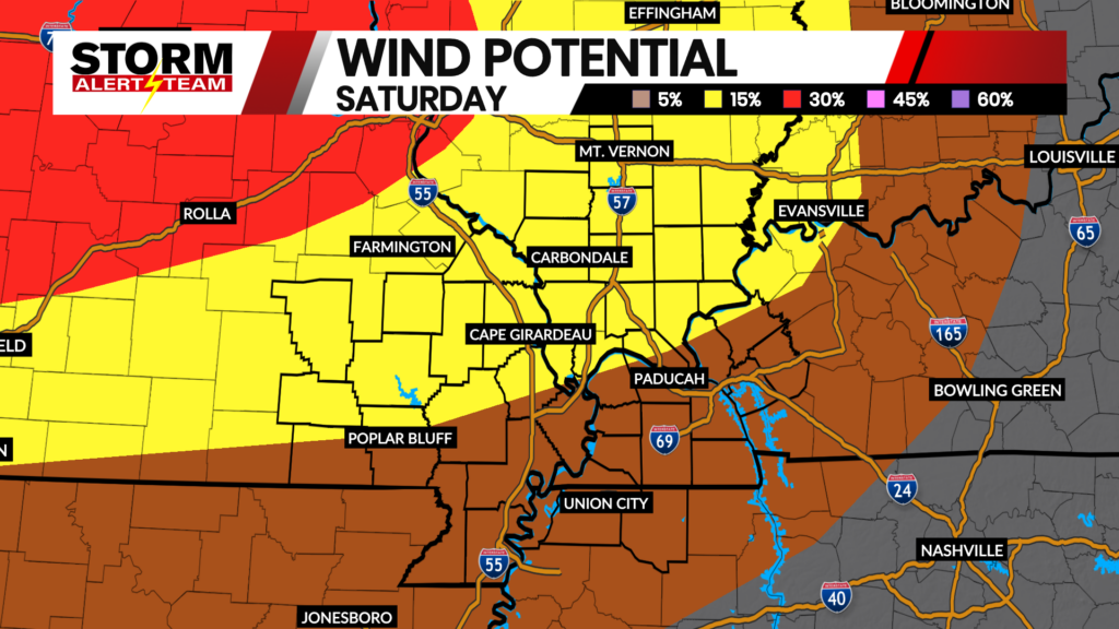
Winds up to 65+ mph will be possible within the cluster of storms this evening.

Meteorologist Houston Hall