Severe weather potential: April 28, 2026
Strong to severe storms will be possible across much of the KBSI viewing area Tuesday afternoon and early evening.
For the latest severe weather alerts, go HERE.
For up to the minute radar, go HERE.
For a live look from our weather cam network, go HERE.
And we would love to see video of any storm footage you may get (safely!). You can upload that using our Now Local News App HERE.

A SEVERE THUNDERSTORM WATCH is in place through 9:00PM for parts of western KY, SW Illinois, southern Missouri, into Arkansas.
A TORNADO WATCH is in place through 10:00PM for northeast Arkansas, western Tennessee, and Dunklin and Pemiscot counties in SE Missouri.

A quick spin up tornado will be possible with storms that push through today. The better chance will be in the brown shaded area in Arkansas.

Large hail is our main concern today. Hail around 1″ in diameter will be possible in the brown shaded area, around 1-1.5″ in diameter will be possible in the yellow shaded area, and up to golf ball size in the red shaded area.

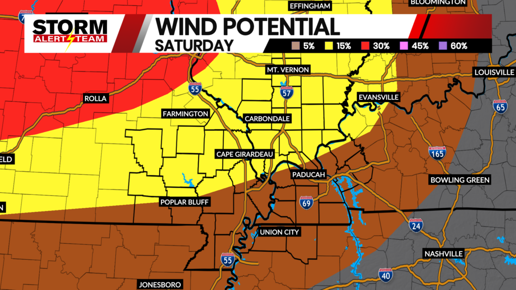
Damaging wind will also be possible with the storms today. The further south you go, the better chance you have at seeing higher wind gust speeds.
Storm Alert Team Chief Meteorologist
Rusty Dawkins