Strong to Severe Storms Possible on Monday
Severe Weather Potential:

Numerous severe storms will be possible across the Heartland on Monday. Now is the time to review your severe weather plan, know your place of shelter, and ensure you have multiple ways of receiving severe weather alerts.
- Latest Storm Alert Team Weather Alerts: Click Here
- For up-to-the-minute radar: Click Here
- Latest Watches/Warnings: Click Here
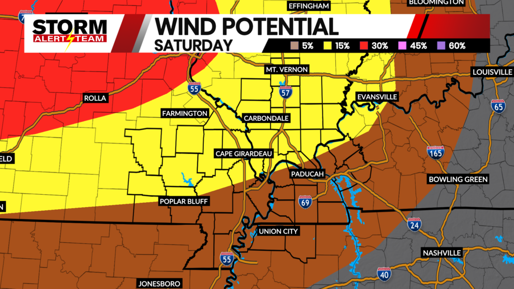
A few, potentially strong tornadoes, 2-inch+ hail, and wind gusts up to 70 miles per hour would be possible in the strongest storms. Above is a breakdown of each hazard and who has the highest chance of seeing them.
The latest run of StormCast shows the potential for a stray severe storm early on Monday morning, leading into the early afternoon. A line of storms then moves across the viewing area during the evening, which is our main concern for severe weather in the region.

Tuesday afternoon and evening will give us another chance at severe weather in the viewing area. All severe hazards are possible, with the greatest chance of storms in western Kentucky and into the Bootheel of Missouri.
Forecast:

Temperatures remain mild tonight ahead of our incoming storm chances on Monday.

There is a chance for storms during the overnight hours for Cape Girardeau, with lows reaching the lower 60s.

Highs tomorrow will reach the lower and middle 80s across the Heartland.

Monday will not be a good day for any outdoor plans in Cape. It is a good idea to review your severe weather plan before leaving for work and school.

Chances for storms continue into Tuesday, but we look to clear out then for the rest of April. Highs for the week ahead will be in the 60s, 70s and 80s.
Storm Alert Team Meteorologist
Dominic Ferraro