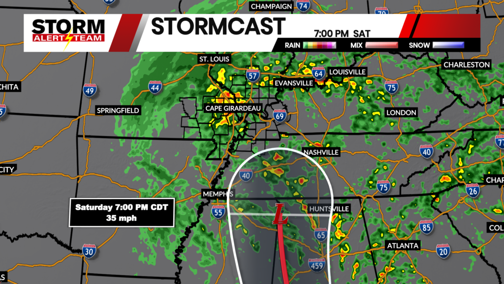
Near Record Highs Friday, Remnants of Hurricane Isaias on Saturday
Weather Headlines:

Sunshine with seasonally warm temperatures closes out the work week in the Heartland. Highs on Friday will reach the upper 80s to lower 90s with southeasterly winds.
Short-range runs for StormCast show quiet weather through the rest of the work week. Expect more active conditions as we head into the weekend with the incoming remnants of Hurricane Isaias.
Hurricane Isaias remains on track to make landfall along the northern Gulf Coast on Friday evening. The system will be quickly ushered north in the jet stream, bringing the potential for rainfall across the viewing area. The risk of severe weather remains low as of Thursday afternoon.

Rainfall totals could exceed over an inch from Friday evening to Sunday evening, though expect a quick cutoff to the north and west. Localized flooding cannot be ruled out, but widespread issues look limited at this time.
Forecast:

Low temperatures are expected to drop closer to average on Thursday night and Friday morning. Mostly clear skies across the viewing area will allow temperatures to fall to the lower 50s.

Once again a quiet evening into the start of the day on Friday for Cape Girardeau. We may need a light jacket heading out the door on Friday morning just to be safe.

Afternoon temperatures are expected to be 10 to 15 degrees above average on Friday afternoon in the Heartland. Air temperatures will reach the upper 80s to lower 90s, though humidity is expected to stay manageable.

Near-record-high heat is in the forecast for Cape. Afternoon temperatures are expected to reach the upper 80s, the current high of 89 degrees (set in 1980) could be in jeopardy.

With the remnants of Hurricane Isaias moving through this weekend, that will bring an end to well above-average temperatures in the viewing area. High temperatures drop to the middle and upper 70s on Saturday.

Storm Alert Team Meteorologist
Dominic Ferraro