Saturday’s storm intensity will lessen heading into the early AM hours Sunday
Saturday nights storm activity will lighten up after 11:oopm but carry into Sunday with a chance for some Early AM showers possible. Temperatures will drop into the 50s and 60s Sunday as the passing cold front makes its way east of us. The afternoon will be mostly cloudy as a storm system continues to pass, gradually the skies will clear up in the evening hours. Monday the sunshine comes out as temperatures warm back into the upper 60s and lower 70s on Monday.

In the early morning hours of Sunday we will see Saturday’s storm system start to weaken as it makes its way east of our area. We still will see the lingering rain showers and overcast skies in the morning on Sunday into the afternoon but ultimately skies clear up in the evening.

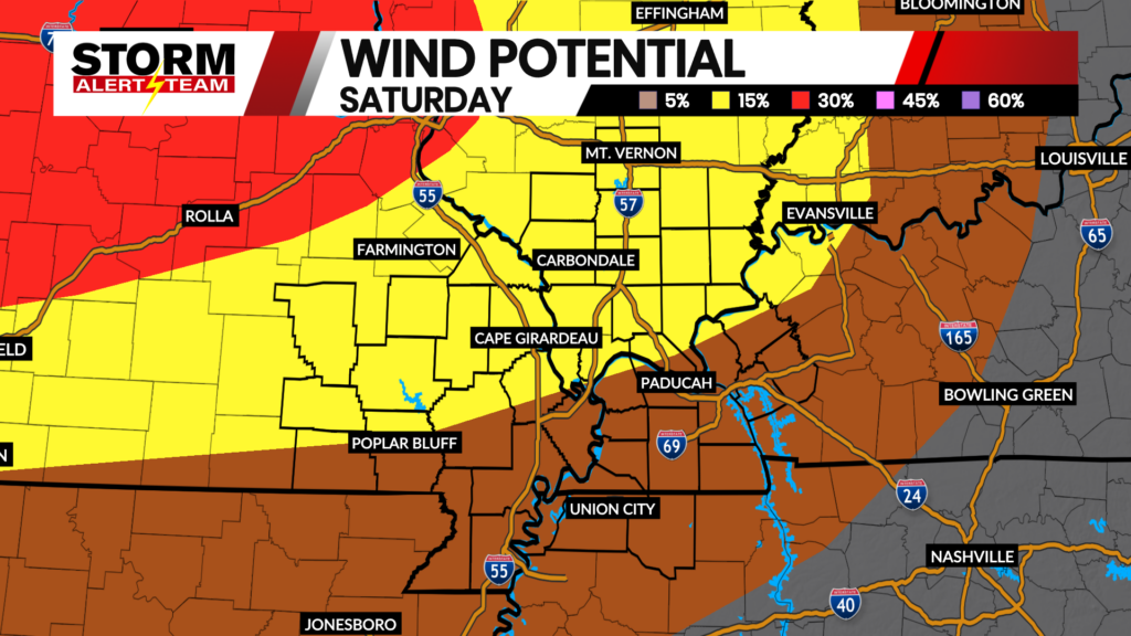
As a cold front passes through the KBSI coverage area temperatures will drop Sunday into the 50s and 60s. Wind speeds are expected to reach 15-20 mph from the west we could be seeing gusts as high as 30 as the front continues to move through out area.

An hour by hour look at Sunday, we are staying cooler than what we have been seeing, we will be in the 50s throughout the day Sunday. As the cold front moves to our east by the evening hours, we are going to warm up but slightly into the upper 50s with our high of 58 tomorrow.

Sunday will be mostly cloudy with a chance to see lingering showers in the morning hours. Monday clears up with mostly sunny skies into Tuesday, then we warm up back into the 70s. We will be seeing party sunny skies on Wednesday with temperatures in the upper 70s. Thursday temperatures go back into the 80s as another storm system makes its way in for Thursday and Friday. We cool back down into the 60s Saturday, with a chance to see more sun.
Weather Forecaster
Krista Chang