NWS confirms 12 tornadoes on May 26
(KBSI) – Twelve tornadoes have been confirmed from severe weather that hit the FOX23 News viewing area on Sunday, May 26.
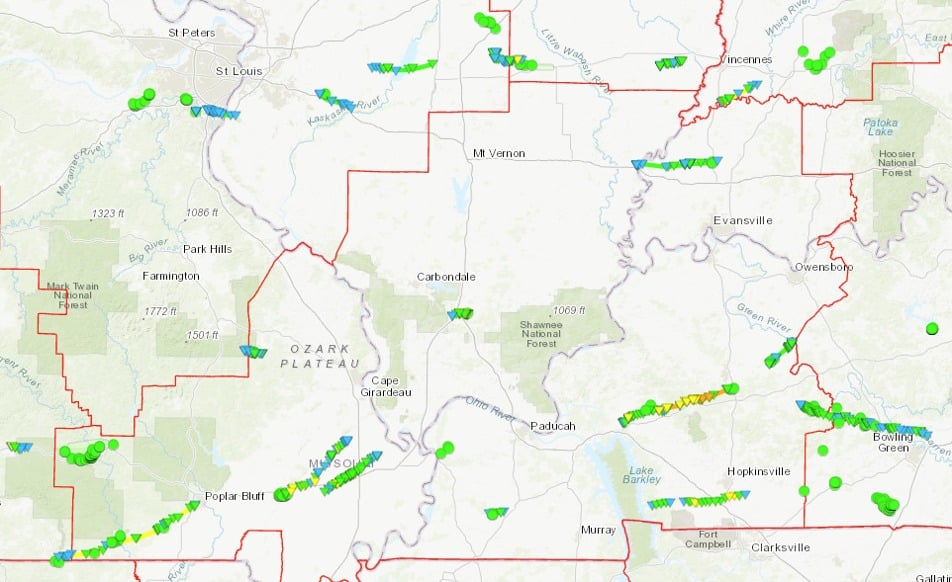
Three of those are EF-3 tornadoes. Tap here to see a map of the tornadoes.
The NWS Paducah shared the results from all the damage surveys teams have done since tornadoes hit the FOX23 News viewing area on Sunday, May 26.
Multiple rounds of severe thunderstorms impacted the region on May 26 producing widespread damage, leaving more than 100,000 customers without power at its peak.
The first wave progressed east across southeast Missouri into western Kentucky and far southern Illinois between 5 and 10 a.m.
This wave was quickly followed by a second line that was mostly sub-severe which then exited our region by 1 p.m., according to the NWS.
The environment was able to recover during the afternoon which provided “ample fuel for another round of severe thunderstorms during the evening.”
Supercells formed across parts of the region between 6 and 9 p.m.
A line of storms developed to the west and moved quickly east-southeast across the entire area after 7 p.m. This line sagged south toward the Kentucky/Tennessee border by 11 p.m.
Widespread damaging winds of 60 to 70 miles per hour occurred with both rounds. There were also large hail up to tennis ball sized and numerous tornadoes.
Below is what teams have found so far, and what other areas we’re still investigating. The tornadoes are listed in chronological order.
- Tornado #1
Gatewood to Fairdealing to Poplar Bluff, MO
Oregon, Ripley, and Butler County, MO
6:15-6:47 AM
EF-2, peak winds of 115 mph
46.7 mile path - Tornado #2
Dexter to Essex to Crowder to Vanduser, MO
Stoddard and Scott County, MO
7:09-7:28 AM
EF-2, peak winds of 125 mph
26.9 mile path
NOTE: Straight line wind damage of 80-100 mph found in most of Dexter. - Tornado #3
Morehouse to Sikeston to Diehlstadt, MO
Stoddard, New Madrid, Scott County, MO
7:15-7:31 AM
EF-3, peak winds of 140 mph
19.6 mile path
1 death - Tornado #4
West of Mayfield, KY
Graves County, KY
8:10-8:15 AM
EF-1, peak winds of 100 mph
5.0 mile path
NOTE: Straight line wind damage found in Mayfield. - Tornado #5
South of Cadiz, KY
Trigg County, KY
8:50-8:56 AM
EF-1, peak winds of 95 mph
6.0 mile path - Tornado #6
Pembroke, KY
Trigg and Christian County, KY
8:59-9:14 AM
EF-2, peak winds of 115 mph
19.1 mile path - Tornado #7
Lynn City and Island, KY
Muhlenberg and McLean County, KY
9:21-9:30 AM
EF-1, peak winds of 90 mph
9.8 mile path - Tornado #8
Goreville and Lake of Egypt Area, IL
Johnson County, IL
6:38-6:48 PM
EF-3, peak winds of 150 mph
5.1 mile path
1 injury
NOTE: Straight line wind damage found near Buncombe, IL - Tornado #9
Marquand and eastward, MO
Madison and Bollinger County, MO
7:25-7:30 PM
EF-1, peak winds of 100 mph
5.5 mile path
NOTE: Straight line wind damage of 80 mph found in Carter County, MO. - Tornado #10
Eddyville/Dawson Springs/Charleston, KY
Lyon, Caldwell, and Hopkins County, KY
8:01-9:15 PM
EF-3, peak winds of 160 mph
35.5 mile path
1 death, 21 injuries - Tornado #11
Grayville, IL, to Fort Branch, IN
White and Wabash County, IL
Gibson County, IN
8:25-8:49 PM
EF-1, peak winds of 110 mph
22.3 mile path - Tornado #12
Beechmont to north of Bowling Green, KY
Muhlenberg, Butler, and Warren County, KY
9:46 to 10:37 PM
EF-1, peak winds of 110 mph
41.1 mile path length
NOTE: 80-90 mph straight line wind damage found in and near Greenville, KY
Areas the National Weather Survey is still investigating.
- Possible tornado from Fort Branch to Somerville, IN
- NWS Paducah will survey parts of this area on Friday, May 31
- Wind damage in Marshall and Calloway County, KY
- NWS Paducah will survey storm damage in this area on Saturday, June 1
NWS survey teams are still surveying wind damage in Marshall and Calloway counties, Kentucky and a possible tornado from Fort Branch to Somerville, Indiana.
NWS Paducah will survey storm damage there on Saturday, June 1.